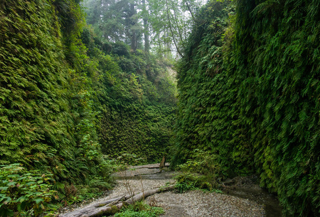
Whether you're interested in a casual walk along bluffs above crashing surf or a longer excursion into the coastal mountains high above the Pacific, hundreds of miles of serene coastal trails await on the California coastline.
Between the Oregon border and Big Sur alone, outings range from wandering through a fairy-tale land of the giant trees of the Redwood Empire to a multi-day, tide-timed trek along the Lost Coast, to a stroll to a waterfall plunging into the ocean at Julia Pfeiffer Burns State Park.
Where to start? Use this list, oriented north to south, to help you start exploring some of coastal Northern California's finest.
Lands End Coastal Trail
The 1.4-mile Coastal Trail at Lands End is a favorite among San Franciscans for good reason. It offers spectacular views of the Golden Gate, the Marin Headlands and the waters of the Pacific. Traversing the coastal bluffs above the ocean between Point Lobos and the Sea Cliff neighborhood, the Coastal Trail provides hikers, runners, bicyclists and beachcombers easy urban access to the Golden Gate's rugged southern edge.
- PROS: Stunning views of the Golden Gate. Beach access. Easy access within San Francisco.
- CONS: Often in fog.
- REGION: San Francisco Peninsula + Santa Cruz, CA
- CONGESTION: High
- DAY-USE/PARKING PASS REQUIRED: Not Required
- TRAIL USES: Hiking, Biking
- TRAIL TYPE: There-and-back
- DOGS ALLOWED: Yes
Pt. St. George Heritage Area
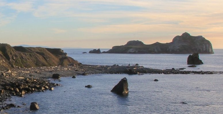
Point St. George Heritage Area, lying just north of Crescent City, is the third westernmost point in the continental United States. The 340 acres of coastal bluffs and rocky shoreline that jut out to sea provide unparalleled panoramas of the surrounding coastline. Panoramic views of Oregon to the north, the Siskoyou Mountains inland, and the forested bluffs of the Redwood Empire to the south make for a spectacular backdrop against the cool blue Pacific Ocean. Walking trails thread the headlands and provide access to the beaches and scenic overlooks before connecting to additional trails that explore the adjacent Tolowa Dunes State Park and a network of coastal lakes and lagoons.
- PROS: Stunning coastal panaromas. Point St. George Reef Lighthouse.
- CONS: None.
- REGION: Redwoods + Del Norte Coast, CA
- CONGESTION: Low
- DAY-USE/PARKING PASS REQUIRED: Not Required
- BEACH: Open, sandy beach, Pebbly Beach, Rocky Shore
- TIDE POOLS: Yes
- WILDLIFE: Seabirds, Harbor Seals, Sea Lions
Stout Memorial Grove
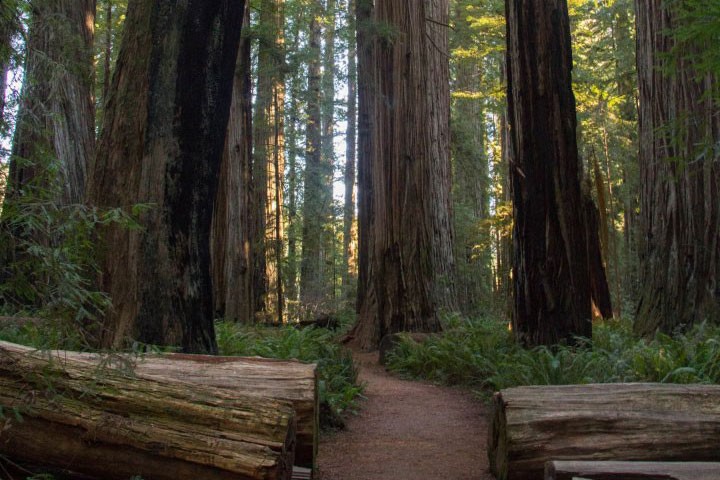
Tucked away from the drive-through limelight of Highway 199, Stout Memorial Grove is out of sight and out of mind for many, if not most, Redwood-bound visitors. Those who do make the side trip down Howland Hill Road to see Stout Grove's magnificent coast redwoods are well rewarded. Stout Grove is arguably the most scenic of the coast redwood groves in Jedidiah Smith Redwood State Park, and the location on the other side of the Smith River from the highway keeps the visitor count down.
- PROS: Cathedral-like redwood grove. Few people.
- CONS: Tougher to find than other nearby groves
- REGION: Redwoods + Del Norte Coast, CA
- CONGESTION: Low
- DAY-USE/PARKING PASS REQUIRED: Not Required
- DOGS ALLOWED: No
Mount Tamalpais State Park
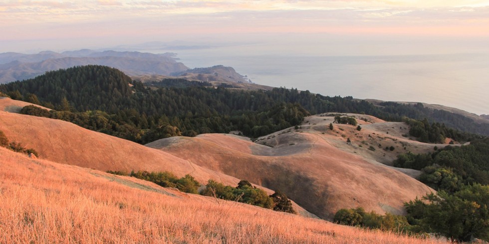
Established in 1963, Mount Tamalpais State Park is one of the Bay Area's open space treasures. Rising above the Marin Headlands, Mount Tam boasts over 50 miles of hiking trails, campgrounds, and Marin's highest point, East Peak, at 2,571 feet. With a diversity of ecosystems ranging from hill covered grasslands to fog-laden redwoods, the park leaves little to be desired when it comes to natural diversity. Mount Tam is connected to a larger network of Marin County open space areas and shares borders with the Golden Gate National Recreation Area, Muir Woods National Monument, and the Marin Municipal Water District, offering visitors a nearly inexhaustible swath of open space and trails to explore.
- PROS: Tallest point in Marin. Vistas. Top-notch hiking trails.
- CONS: Can get crowded on weekends.
- REGION: Marin, CA
- CONGESTION: Moderate
- DAY-USE/PARKING PASS REQUIRED: State Park Fee ($10.00)
- PICNIC TABLES: Yes
Elk Head Trail
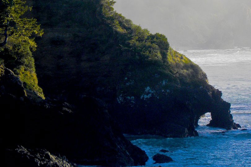
This trail is an easy there-and-back that provides great views and access to College Cove Beach. The trail is easy to follow and clearly marked, and the first portion of the trail provides some great viewing points for looking down on the beach. The coastal spruce forest has a lush understory of ferns, moss, wild flowers; as you approach the open areas, watch for a variety of birds such as common murres, brown pelicans and gray jays. The beach is a local favorite, and the cove provides shelter for safe swimming and surfing in the warmer months. You can see that the beach is actually separated in the middle (access between the two is possible during low tide only), and on the southern end there is a rock formation with a visible natural arch.
- REGION: Humboldt, CA
- CONGESTION: Moderate
- DAY-USE/PARKING PASS REQUIRED: Not Required
- DOGS ALLOWED: Yes
The Lost Coast Trail
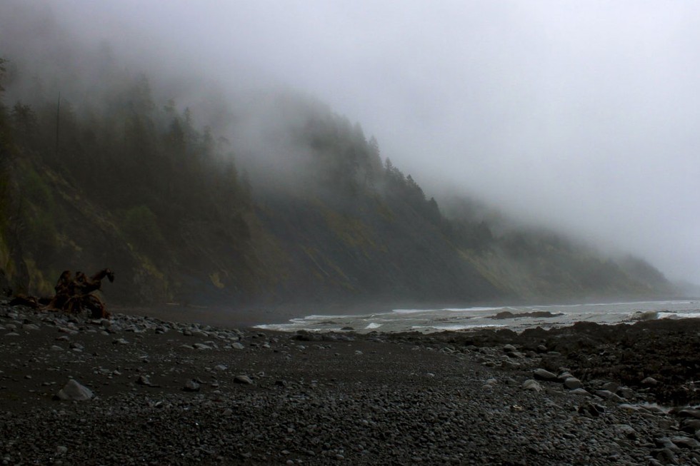
The Lost Coast Trail is a wild and unique backpacking adventure along one of the most rugged sections of the Northern California Coast. The King Range area is nearly untouched by civilization, with only a few small towns along the two-hour shuttle from Shelter Cove to the Mattole Beach trailhead to the north. The trail provides incredible views, a variety of wildlife and flora, and a glimpse of some rarely seen California coastal terrain. Keep in mind that portions of this trip take a great deal of effort; the majority of the 25-mile, 3-day trip takes place on sandy beaches, which can be exhausting for legs and feet.
- PROS: Beautiful landscape. Only backpackers. Wildflowers. Plenty of water.
- CONS: Long shuttle ride. Hard on legs and feet. Many river crossings.
- REGION: Humboldt, CA
- CONGESTION: Low
- PREFERABLE SEASON(S):Spring, Summer, Fall
- DAY-USE/PARKING PASS REQUIRED: Not Required
- DOGS ALLOWED: Yes
Fern Canyon Trail
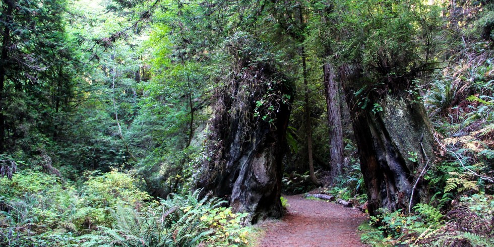
Not to be confused with Fern Canyon of Russian Gulch Sate Park found only a few miles to the north, this Fern Canyon Trail is tucked away at the east end of Van Damme State Park. The trail is known for it's lush environs, spawning habitat for salmon and steelhead, and as a connector trail to a cypress and pine pygmy forest found a few miles inland.
- PROS: Open to hiking and biking. Ferns.
- CONS: Bridges crossing Little River are removed during winter.
- REGION: Mendocino Coast + Clear Lake Area, CA
- CONGESTION: Moderate
- PREFERABLE SEASON(S): Spring, Summer, Fall
- DAY-USE/PARKING PASS REQUIRED: State Park Fee ($8.00)
- TRAIL USES: Hiking, Biking
- TRAIL TYPE: There-and-back
- DOGS ALLOWED: No
Kortum Trail
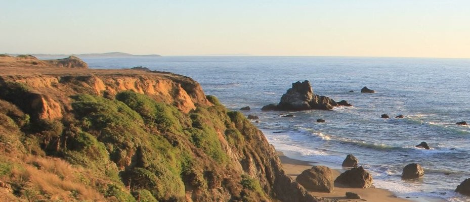
Approximately 8 miles north of Bodega Bay, a beautiful stretch of coastal bluffs is made accessible by an inconspicuous coastal path known as the Kortum Trail. Connecting Blind Beach near Goat Rock in the north to Wright's Beach in the south, the full length of the Kortum Trail traverses 3.8 miles of Sonoma Coast State Park and offers sweeping views of the great blue Pacific, offshore sea stacks, and access to a fun little climbing crag along the way. The most scenic and interesting part of the trail is the northern section, which starts near the Blind Beach parking area and continues 2.25 miles south to Shell Beach.
- PROS: Ocean views. Bouldering rocks.
- CONS: Can be windy.
- REGION: Sonoma Coast + Napa Area, CA
- CONGESTION: Low
- DAY-USE/PARKING PASS REQUIRED: Not Required
- TRAIL USES: Hiking
- TRAIL TYPE: There-and-back
- DOGS ALLOWED: No
Chimney Rock
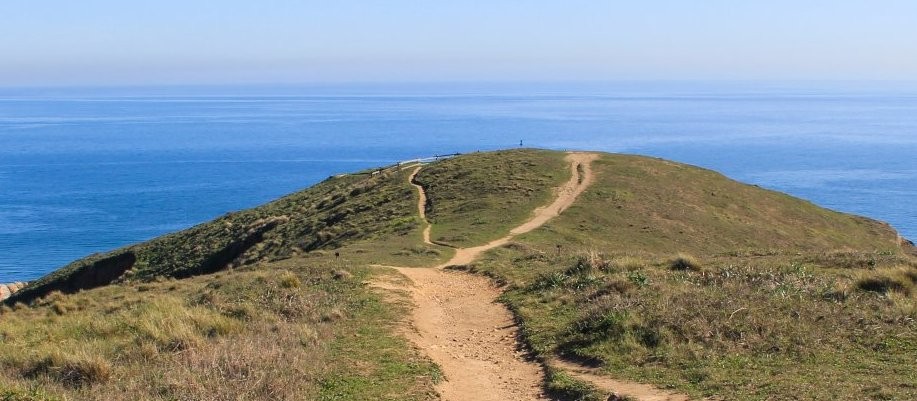
Part of the Point Reyes National Seashore, this short hike out to Chimney Rock provides an unparalleled perspective on the beauty of Drake's Bay and the surrounding swath of Pacific Ocean. The Chimney Rock trail traverses the exposed, bluff-lined peninsula that forms the eastern section of Point Reyes, heading out to the tip and an overlook of the ocean, Drakes' Bay, and Chimney Rock. Despite the trail's name, Chimney Rock itself might be the least exciting feature of the hike; rather, views of the unique coastline, marine life, Point Reyes' lifeboat history, and spring wildflowers steal the show.
- PROS: Scenic Point Reyes vistas. Wildlife. Unique coastline terrain.
- CONS: Often foggy or windy.
- REGION: Marin, CA
- CONGESTION: Moderate
- PREFERABLE SEASON(S): Winter, Spring, Fall
- DAY-USE/PARKING PASS REQUIRED: Not Required
- TRAIL USES: Hiking
- TRAIL TYPE: There-and-back
- DOGS ALLOWED: No
Sky Trail Loop, Bear Valley to Mount Wittenberg
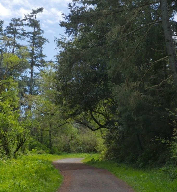
Point Reyes National Seashore is a 70,000-acre outdoor playground about 30 miles north of San Francisco. With ample trails, campgrounds, and beaches, Point Reyes attracts outdoor and nature enthusiasts from around the world. The area has a resident tule elk herd, a huge variety of bird species, and it is a favorite mating spot for northern elephant seals.
- PROS: Beautiful forests and views. Various loops and lengths available.
- CONS: Can be crowded.
- REGION: Marin, CA
- CONGESTION: Moderate
- DAY-USE/PARKING PASS REQUIRED: Not Required
- TRAIL USES: Hiking
- TRAIL TYPE: There-and-back/Loop
- DOGS ALLOWED: No
Palomarin to Alamere Falls
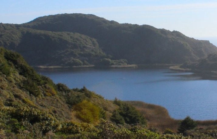
The trip to Alamere Falls offers stunning coastal views of Point Reyes National Seashore and a wonderfully unique waterfall. The landscape is varied with coastal scrub pine and oak forests, and there are several lakes along the way. Alamere Falls pours from a rocky cliff onto a long, wide stretch of beach, and it is the perfect place to enjoy a lunch break or an afternoon stroll in the sand.
- PROS: Coastal views. Swimming lake. Waterfalls.
- CONS: Weekend crowds. Poison oak.
- REGION: Marin, CA
- CONGESTION: High
- DAY-USE/PARKING PASS REQUIRED: Not Required
- TRAIL USES: Hiking
- TRAIL TYPE: There-and-back
Muir Woods via Deer Park Fire Road
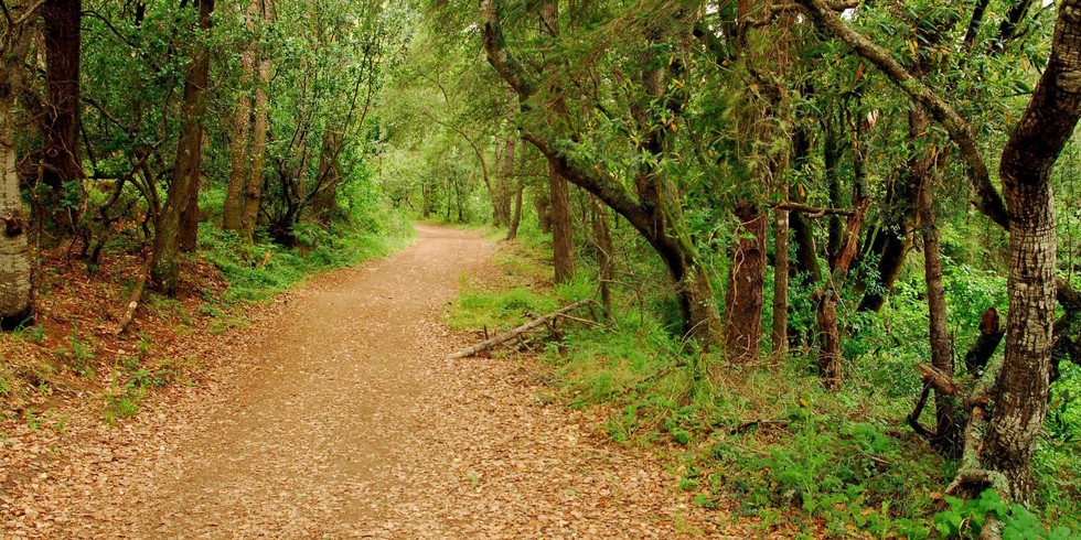
With nearly one million annual visitors, Muir Woods National Monument can feel like a tourist zoo at times, particularly on weekends. Fortunately, there's a little known back-door entrance, that offers a pleasant hike with coastal views, ridges, and redwood stands via the Deer Park Fire Rd. that is a guaranteed way to avoid the crowds.
- PROS: Pacific Ocean views. Back door/less crowded route into Muir Woods.
- CONS: Weekend parking and crowds.
- REGION: Marin, CA
- CONGESTION: Moderate
- DAY-USE/PARKING PASS REQUIRED: General Day Use Fee ($5.00)
- TRAIL USES: Hiking
- TRAIL TYPE: Loop
- DOGS ALLOWED: No
Coastal Trail, Rodeo Beach to Muir Beach
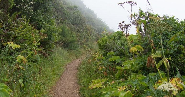
This section of the Coastal Trail begins not to far from Marin Mammals Center at Rodeo Beach, a unique beach with red and green pebbly chert grains. You'll quickly note the dilapidated military structures that are visible in the distance; in contrast to Rodeo Beach's Fort Barry and Fort Cronkhite, both of which serve as National Park Service facilities, all of the batteries and small gun emplacements on the ridge are empty and abandoned, their walls covered by graffiti.
- PROS: Pretty coastal views. Beaches.
- CONS: Can get foggy. Crowds.
- REGION: Marin, CA
- CONGESTION: High
- PREFERABLE SEASON(S): Spring, Summer, Fall
- DAY-USE/PARKING PASS REQUIRED: Not Required
- TRAIL USES: Hiking, Biking, Horseback
- TRAIL TYPE: There-and-back
Marin Headlands
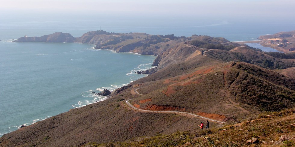
While the Marin Headlands may be best known for front-and-center views of the Golden Gate Bridge found at Battery Spencer, there is much to explore beyond this heavily traveled viewpoint. Encompassing 2,100 acres of rugged, hilly landscape overlooking the Pacific, the Marin Headlands have been protected and managed by the National Park Service as part of the Golden Gate National Recreation Area since 1970, and for good reason. The area is an outdoor recreation treasure trove. With dozens of miles of hiking and mountain biking trails, walk-in campgrounds, a handful of spectacular beaches and numerous historical sites of interest, the viewpoints only scratch the surface of this outdoor playground.
- PROS: Beautiful vistas. Diversity of recreational actvities.
- CONS: Battery Spencer crowds
- REGION: Marin, CA
- CONGESTION: High
- DAY-USE/PARKING PASS REQUIRED: Not Required
Steep Ravine Trail to Dipsea Trail Loop
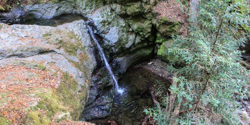
Mount Tamalpais State Park's Steep Ravine Trail is a worthy hike by itself, but when you add the western stretch of the Dipsea Trail to make a loop out of the hike, this becomes one of Mount Tam's most spectacular jaunts. The Steep Ravine Trail follows Webb Creek through a cascading canyon under a canopy of lush redwoods and fern-filled gullies. Pass over a handful of wooden bridges that crisscross the creek, and even scramble up a 10-foot ladder surmounting moss covered boulders. This shaded, verdant oasis feels like Land Before Time territory, and thoughts of urban hustle and bustle float away with the creek's flow.
- PROS: Diversity of landscapes throughout loop. Free parking at Whitegate Ranch Trailhead.
- CONS: None.
- REGION: Marin, CA
- CONGESTION: Moderate
- DAY-USE/PARKING PASS REQUIRED: Not Required
- TRAIL USES: Hiking
- TRAIL TYPE: Loop
Article and images sourced from http://www.7x7.com/the-best-hikes-on-the-northern-california-coast-1787295440.html#